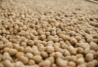
Despite the ongoing La Niña conditions, which are typically associated with reduced winter precipitation across California, a persistently negative Pacific North America (PNA) pattern during December promoted frequent storminess tracking south from the Gulf of Alaska to California.
These storms brought widespread above-average snows to the Cascades, Sierras, coastal ranges, and to a lesser extent the Rockies, with heavy rainfall at lower elevations boosting streamflows and causing some flooding impacts. While drought conditions still blanket most of the West, the beneficial precipitation reduced the intensity of the drought across wide areas west of the Continental Divide.
Further east, mostly dry conditions and much above normal temperatures caused an unusually rapid December drought expansion across the central and southern Plains, lower Mississippi Valley, and the South Atlantic states, while periods of storminess and not yet frozen streams allowed some relief across the upper Midwest.
During January, the updated CPC temperature and precipitation guidance indicates a colder pattern for the northern tier, with enhanced precipitation favored for the Northwest and northern Rockies. In contrast, abnormal warmth and dryness are favored to persist across the south-central US and along the Gulf Coast.
Heavy precipitation in early January coupled with the wetter signal on the monthly time scale favor continued easing of drought across the Northwest and northern Rockies, while near term precipitation events may bring localized relief to southern California and southern Arizona and New Mexico.
Drought expansion is favored to continue across central Texas, Louisiana, and parts of the Florida Panhandle. Across the East, wet weather in early January may be sufficient to slow the advancement of drought, but accumulations are not expected to be sufficient to promote widespread relief.
An active pattern across the upper Midwest and Great Lakes region may yield some improvements where streams remain unfrozen, but most areas have frozen soils and streams, which will delay the impacts of any precipitation that falls during January.
Drought conditions have eased substantially across Hawaii, and an anticipated continuation of storminess and enhanced trade winds favors removal of the remaining drought areas. La Niña winter months are typically dry across the Caribbean, but mixed signals in the dynamical model forecasts precludes a forecast for continued drought expansion across Puerto Rico. No drought is currently in place or forecast to develop across Alaska, with cold conditions favored during January.
Forecast confidence is moderate for the Western Region.
- While drought conditions remain prevalent across the Western Region with nearly 90 percent drought coverage as of the December 28, 2021 US Drought Monitor, December brought substantial precipitation and reduction of drought intensity west of the Continental Divide.
- Snowpack conditions remain generally below normal along the front range of the Rockies, but snow water equivalent (SWE) levels are near to above climatology across the remainder of the Intermountain West. SWE values exceeding 200 percent of normal are common across the central Sierra Nevadas, with below-normal temperatures increasing snowpack coverage at lower elevations.
- A persistently negative Pacific North America (PNA) pattern that favors troughing over the western CONUS and a more southerly storm track helped generate the repeated heavy precipitation events despite the La Niña background state.
- In the near term, another high impact precipitation event caused flooding across the Los Angeles metro area and brought heavy snows to the coastal ranges of southern California.
- During the next 7 days, heavy coastal rainfall and mountain snows are forecast across northern California, the northern Sierras, and the Pacific Northwest. Heavy precipitation is anticipated to move further inland as well, bringing widespread snows to the central and northern Rockies, and higher elevations of southern Arizona and southwestern New Mexico.
- During Week-2, the GEFS favors a pattern shift, with the negative PNA giving way to increased ridging across the West, resulting in a drier pattern.
- The updated January 2022 outlooks from CPC favor above-normal precipitation across northern California and the northern Great Basin, as well as the Pacific Northwest, northern Rockies, and northern High Plains. In contrast, below-normal precipitation is favored across the Southwest.
- Given the heavy precipitation forecast in the short term, further drought improvements are favored for northern California, the Pacific Northwest, and the central and northern Rockies.
- Heavy precipitation over the next 7 days may also bring localized drought relief to southeastern Arizona and southwestern New Mexico, and further drought reduction is likely across southern California as recent heavy precipitation works its way into reservoirs, streams, and the groundwater supply.
- Elsewhere, persistence is maintained, including along the northern High Plains despite the wet monthly outlook, as precipitation is unlikely to be sufficient to promote substantial changes to the ongoing drought conditions.
Forecast confidence is moderate to high for the High Plains Region.
- Across the High Plains Region, seasonable dryness coupled with much above normal temperatures promoted widespread drought expansion and degradation across eastern Colorado, Kansas, and southern Nebraska, while a wetter pattern across the Northern Tier prompted some localized improvements across the Dakotas and eastern Wyoming.
- During January, a wet pattern is favored to extend across the central and northern Rockies and portions of the northern High Plains. While this precipitation is favored to bring some drought relief across the Rockies, precipitation amounts are not anticipated to be sufficiently high to effect much change to the ongoing drought conditions across the High Plains.
- Below-normal precipitation is favored during January across southwestern Kansas, limiting the potential for any drought relief.
- Dynamical model forecasts for January have trended colder towards the end of December, and frequent outbreaks of Arctic air onto the Plains is likely. The presence of colder air is likely to slow the expansion of drought that was observed during December.
- Therefore, drought improvement is favored for the mountainous regions of western Wyoming, while persistence is maintained across the remainder of the High Plains region, with no development areas indicated.
Forecast confidence is moderate for the Southern Region.
- Dry, unseasonably warm conditions during December promoted substantial expansion of drought and abnormal dryness impacts across the Southern Region, most notably across Oklahoma and Texas, while storm systems developing along frontal boundaries generated some relief across Arkansas.
- During the next 7 days, a storm system is favored to develop and bring additional localized heavy precipitation to southeastern Oklahoma and Arkansas, which may prompt some further localized drought reductions.
- A drier pattern is favored to overspread the region during Week-2, however, and the updated CPC monthly outlooks for January favor below-normal precipitation and above-normal temperatures across Texas, Oklahoma, and the central Gulf Coast.
- Based on the lack of substantial follow-up precipitation during mid-January, persistence is maintained for eastern Oklahoma and Arkansas despite the anticipated short term precipitation.
- Drought development is favored for central Texas and southern Louisiana due to the warm, dry pattern favored during January.
Forecast confidence is moderate to high for the Midwest Region.
- A pocket of lingering drought remains across eastern Missouri, with more substantial drought areas remaining entrenched across the northern Mississippi Valley and western Great Lakes region.
- Above-normal precipitation during the last 30 days eased some of the drought across Minnesota, while impacts slowly increased across southern Wisconsin.
- During January, the updated CPC monthly outlooks favor above-normal precipitation and below-normal temperatures for the upper-Midwest and Great Lakes regions, with equal chances maintained across much of Missouri. While potential wet weather may ease drought conditions across the upper-Midwest, the benefits may be slow to materialize due to frozen soils and streams.
- Therefore, despite the favorable outlooks, persistence is maintained across Minnesota and northern Wisconsin, but improvements are indicated across southern Wisconsin, northern Illinois, and far eastern Iowa, where above-median precipitation is favored and the streams are still largely flowing.
Forecast confidence is low to moderate for the Southeast and Northeast regions.
- Under persistent warm and dry conditions, drought has steadily expanded across the central Appalachians and parts of the South- and Mid-Atlantic states.
- Further north, while most drought has been removed from New England, a small area of moderate drought remains entrenched across western Maine.
- Streamflow values are very low across much of the mid-Atlantic, but low evapotranspiration rates and dormant crops have limited the impacts of the dryness.
- During late December, showers overspread much of Alabama and Georgia, slowing the expansion of drought conditions.
- The 7-day QPF forecast shows widespread precipitation across the East, with forecast amounts in excess of 1.5 inches in the core drought areas of North Carolina and Virginia, and most areas receiving at least 0.5 inches.
- The CPC 6-10 forecast continues the wet pattern, with conditions returning to near normal in the 8-14 day time frame.
- Given the anticipated precipitation in early January, drought expansion across the mid-Atlantic is not favored, but the lack of a clear wet signal east of the Appalachians in the updated January outlook makes substantial drought reductions less likely as well. Therefore, persistence is maintained across the South and Mid-Atlantic states.
- A potential favored storm track into interior New England during La Niña winters increases the odds for drought removal across western Maine.
- A small area of drought development is indicated on the outlook along the Florida Panhandle, where there is a dry signal on the monthly time scale.
Forecast confidence is high for Hawaii and Alaska, and low for Puerto Rico.
- Very wet conditions, including a Kona Low event, have resulted in substantial drought reductions across Hawaii, in addition to heavy high elevation snows and widespread flooding. Currently only small areas of moderate drought remain on Molokai and Maui, with the remaining islands drought free.
- Given the enhanced trade wind regime typical during La Niña events and the potential for additional midlatitude cyclone intrusions into the vicinity of Hawaii, an active pattern is favored to continue during January. Therefore, removal of the remaining drought areas is the most likely outcome.
- No drought is currently depicted or predicted for Alaska, with near to below-normal temperatures favored during January.
- Across Puerto Rico, drought conditions and abnormal dryness have slowly expanded over the past two months. La Niña winters tend to be dry across the Caribbean, favoring continued slow drought expansion, but dynamical model forecasts for January show mixed signals, increasing uncertainty. Therefore, drought persistence is maintained, but further expansion is not indicated on the outlook.